EMEP model in the PRD region (Pearl River Delta)
A number of activities are ongoing in order to improve the performance of the EMEP model in Eastern China, and in particular in the PRD region:
- update of the land use data (from GLC2000 to GCL2015, merged with PRD2020 and 2035 urban planning maps)
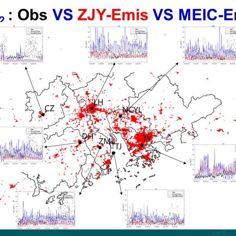
- update of emissions: moving from MEIC 2012 to local PRD data provided by the research group of Prof. Zhang Jun Yu / SCUT, and improvement of large point sources (including emission heights) provided by Tsinghua University
- testing of boundary conditions and meteorological data
- investigation of BVOC emissions
The figure below shows examples of EMEP model performance at a number of stations in the PRD, using different emission data.
